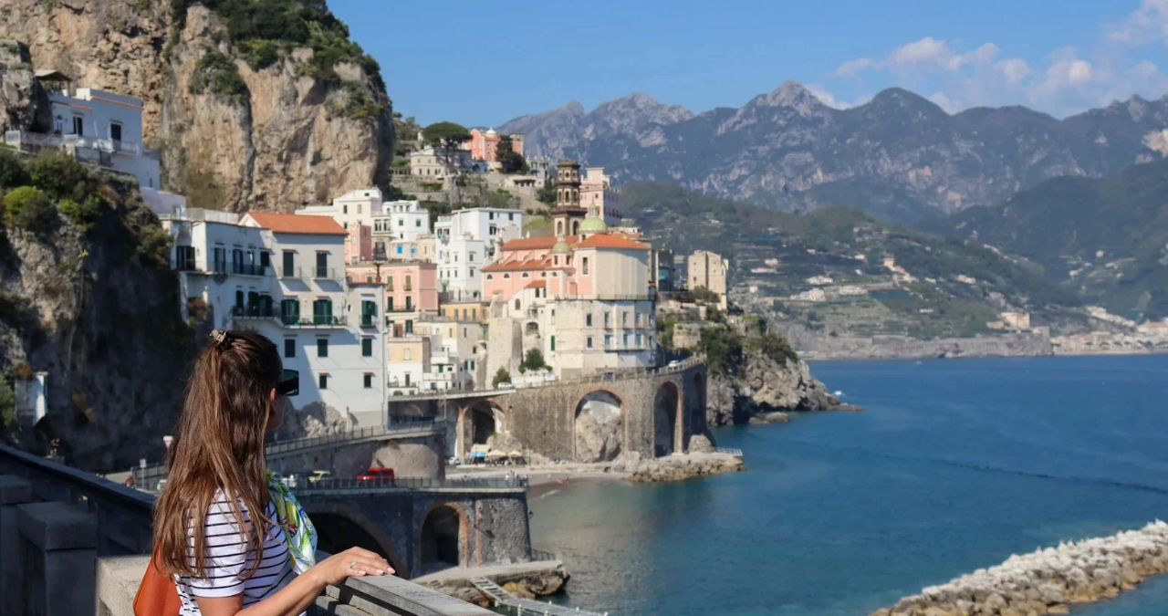
The amalfi coast map is one of the most useful tools for understanding this spectacular part of southern Italy. At first glance, the Amalfi Coast can look like a simple line of colorful villages beside the sea. In reality, its geography is much more complex. Steep mountains, winding roads, deep valleys, stairways, beaches, and cliffside settlements all come together to create a destination that rewards careful planning.
The Amalfi Coast lies along the southern side of Italy’s Sorrentine Peninsula in the Campania region, facing the Tyrrhenian Sea and the Gulf of Salerno. It is also a UNESCO World Heritage cultural landscape, recognized for the remarkable relationship between nature, architecture, agriculture, and human settlement. UNESCO describes the area as covering about 11,231 hectares and including a network of municipalities, agricultural landscapes, and protected natural areas.
A good map helps travelers see how the famous destinations connect. It can show where Positano sits in relation to Amalfi, why Ravello is above the coast, where Maiori and Minori are located, and how Vietri sul Mare forms the eastern gateway. So, whether you’re planning a short holiday, a scenic road trip, a walking adventure, or simply learning about Italy, understanding the amalfi coast map is a smart place to start.
Understanding the amalfi coast map
The Amalfi Coast stretches along a dramatic section of the Sorrentine Peninsula. The best-known coastal route runs between Positano in the west and Vietri sul Mare in the east. Italy’s official tourism portal describes this area as a famous stretch of coastline with cliffs, coves, terraces, citrus groves, vineyards, villages, and historic landmarks.
The landscape is not flat. That’s the first thing to remember when looking at a map.
Instead, the mountains rise sharply behind the villages, while the sea opens out in front of them. Some towns sit directly beside the water, while others are built higher on slopes or mountain terraces.
This unusual geography explains several things travelers notice immediately:
- Roads can be narrow and winding.
- Distances can look short on a map but take longer by road.
- Stairways are an important part of local travel.
- Some viewpoints require uphill or downhill walking.
- Nearby villages may be connected by hiking paths as well as roads.
- Boats can sometimes provide a very different perspective from land travel.
The official Amalfi Coast tourism website provides maps showing the main towns, points of interest, and bus routes, making maps particularly useful for first-time visitors.
Where the Amalfi Coast is located
The Amalfi Coast is in southern Italy, in the province of Salerno in the Campania region. It is south of Naples and occupies the southern side of the Sorrentine Peninsula.
Looking at a broader map of Italy, the area sits below Naples and around the Gulf of Salerno. The coastline faces the Tyrrhenian Sea.
This location puts the Amalfi Coast within reach of several famous Italian destinations, including:
- Naples
- Sorrento
- Pompeii
- Mount Vesuvius
- Salerno
- Capri
That wider geographical picture is important because many visitors don’t travel to the Amalfi Coast as an isolated destination. Instead, they combine it with other places in Campania.
For example, someone might stay in Sorrento and explore Positano and Amalfi as day trips. Another traveler might use Salerno as a base and explore the eastern side of the coast. Others may arrive from Naples before continuing toward the coastal villages.
The location also explains why the coast feels so different from major Italian cities. Instead of broad streets and large open spaces, you’ll find mountains, cliffs, terraces, small lanes, and compact historic centers.
The main towns shown on the amalfi coast map
One of the easiest ways to understand the coast is to study its major towns from west to east.
A commonly used coastal sequence is:
Positano → Praiano → Conca dei Marini → Amalfi → Atrani → Minori → Maiori → Cetara → Vietri sul Mare
Other important settlements, including Ravello, Scala, Furore, and Tramonti, are located higher inland or above the main coastal road.
The UNESCO Amalfi Coast organization identifies a broader collection of municipalities within the World Heritage landscape, while different tourism sources may use slightly different boundaries when describing the “Amalfi Coast.”
Here’s a simple guide:
| Place | General location | What it is known for |
|---|---|---|
| Positano | Western coast | Cliffside views, colorful buildings, beaches |
| Praiano | Between Positano and Conca dei Marini | Sunsets, quiet atmosphere, coastal views |
| Conca dei Marini | Near Amalfi | Coves and Emerald Grotto area |
| Amalfi | Central coast | Historic center, cathedral, maritime history |
| Atrani | Beside Amalfi | Compact village and traditional streets |
| Ravello | Above Amalfi | Gardens, villas, mountain and sea views |
| Scala | Above Amalfi | Historic mountain settlement and walking routes |
| Minori | Eastern-central coast | Beach, Roman heritage, food traditions |
| Maiori | Eastern-central coast | Larger beach area and coastal access |
| Cetara | Eastern coast | Fishing heritage and local seafood traditions |
| Vietri sul Mare | Eastern gateway | Famous ceramics and access toward Salerno |
The exact experience of each place varies considerably. That’s why a detailed amalfi coast map is much more helpful than simply searching for one famous town.
Positano on the amalfi coast map
Positano is one of the most recognizable locations on the entire coast.
On a map, it sits toward the western end of the famous coastal stretch. The town appears to climb dramatically from the sea toward the hills.
This vertical layout is part of Positano’s charm. Buildings seem to stack one above another, connected by streets, stairways, terraces, and narrow passages.
For visitors, a map can help identify:
- Spiaggia Grande
- The historic center
- Main road connections
- Viewpoints
- Nearby beaches
- Hiking routes
- Boat departure areas
Positano is also an excellent example of why straight-line distance doesn’t always tell the whole story. A destination may look close on a map, but steep terrain and road conditions can make the actual journey much longer.
The town is particularly attractive for travelers interested in photography, shopping, coastal scenery, architecture, and beach experiences.
Amalfi at the heart of the map
Amalfi gives the coastline its name and sits roughly in the central part of the famous coastal route.
It has a different character from Positano. Instead of focusing only on dramatic hillside scenery, Amalfi has a strong historical identity connected to its maritime past.
The town developed as an important maritime center and later became one of the defining historic settlements of the region. UNESCO highlights Amalfi’s architecture and artistic heritage as part of the cultural importance of the wider World Heritage landscape.
When looking at an amalfi coast map, Amalfi is a useful central reference point because several routes and nearby settlements connect around it.
From Amalfi, travelers can explore:
- Atrani
- Ravello
- Scala
- Valle delle Ferriere
- Conca dei Marini
- Minori
- Maiori
The town is also an important transport point, with buses and other connections serving surrounding communities.
Ravello and the mountains above the coast
Ravello is a fascinating reminder that the Amalfi Coast isn’t only about seaside towns.
On the map, Ravello is located above Amalfi rather than directly beside the sea. Its elevated position gives visitors wide views across the coastline.
This difference is extremely important when planning a trip.
Someone looking only at a basic map might think Ravello is another coastal village. It isn’t. Its location is higher, and reaching it involves climbing away from the shoreline.
Ravello is famous for its historic villas, gardens, cultural heritage, and panoramic views. UNESCO specifically identifies Ravello as one of the towns containing significant architectural and artistic works.
For travelers who enjoy scenery, gardens, history, music, and peaceful viewpoints, Ravello can be a highlight.
Atrani, Minori, and Maiori
Smaller destinations often become easier to understand once you have a detailed amalfi coast map.
Atrani sits immediately beside Amalfi and is known for its compact urban layout. The UNESCO Amalfi Coast organization describes it as a densely built settlement with narrow alleys and houses positioned closely together.
Moving eastward, Minori sits in a valley near the coast. It also has important Roman archaeological remains, including the remains of a Roman villa.
Maiori is farther east and has a broader beach area than many of the coast’s smaller settlements. Its location makes it useful for travelers who want a different balance of seaside space and access to other areas.
These towns demonstrate why travelers shouldn’t assume that every Amalfi Coast village offers exactly the same experience.
Some are ideal for:
- Beaches
- History
- Food
- Hiking
- Photography
- Quiet stays
- Transport connections
The right choice depends on what you want from your trip.
Vietri sul Mare and the eastern gateway
On the eastern side of the traditional coastal route, Vietri sul Mare provides an important geographical reference point.
It is close to Salerno and is particularly famous for ceramics. Italy’s tourism information highlights Vietri’s distinctive ceramic tradition as part of the cultural character of the region.
On an amalfi coast map, Vietri sul Mare helps travelers understand where the famous coastline begins or ends depending on the direction of travel.
This makes it useful for visitors arriving from Salerno.
The eastern side of the coast can also feel different from the highly photographed areas around Positano. Exploring beyond the most famous locations can reveal a broader picture of local life, crafts, food, and history.
Roads and driving routes on the amalfi coast map
The famous coastal road is one of the defining features of the region.
It winds along cliffs and through settlements, creating spectacular views but also demanding careful driving.
A map is particularly useful when planning a road journey because the route doesn’t behave like a straight highway.
According to local tourism information, the main coastal road connects the towns along the coast, while journey times can increase during busy periods because of the narrow road and traffic.
If you’re considering driving, keep these points in mind:
- Allow extra time for traffic.
- Don’t judge journey time only by kilometers.
- Expect winding sections.
- Parking can be difficult in popular towns.
- Larger vehicles may be less convenient.
- Avoid rushing from one attraction to another.
- Check local traffic and parking conditions before setting off.
In other words, the Amalfi Coast isn’t a place where you should try to squeeze every destination into a tight schedule.
Slow and steady wins the race here.
Public transportation and the amalfi coast map
Public buses are an important part of transportation along the coast. A dedicated Amalfi Coast map can help visitors understand the main bus routes and connections.
For many travelers, public transportation is a practical alternative to driving.
A map can help you work out:
- Which town you want to reach
- Where the bus route runs
- Where you need to change
- How far the stop is from your accommodation
- Whether a destination requires walking after arrival
However, transportation conditions can change depending on season, traffic, weather, and operational schedules. It’s wise to check current information shortly before traveling rather than relying on an old timetable.
The geography also means that getting somewhere isn’t always simply a matter of finding the shortest road. Sometimes the most sensible journey involves a combination of bus, boat, and walking.
Boats and the sea view of the Amalfi Coast
One of the best ways to understand the geography is from the water.
From the sea, the dramatic relationship between mountains, villages, terraces, and cliffs becomes much easier to see.
A road map shows the route from one town to another. A boat journey shows the vertical landscape.
You can see how:
- Villages rise above the water.
- Roads cut through cliffs.
- Houses spread across slopes.
- Beaches occupy small coastal spaces.
- Terraced agriculture covers sections of the mountains.
The view also explains why the Amalfi Coast has become so famous around the world.
UNESCO describes the landscape as a combination of rocky areas, forests, citrus groves, vineyards, terraces, historic settlements, and natural features.
So, while a map is useful for practical planning, the coastline itself tells a much bigger story.
Hiking routes and the vertical coast
The Amalfi Coast is often described as a “vertical” landscape, and that description is spot on.
Historic stairways and mountain paths connect places that may appear close together on a horizontal map.
The UNESCO Amalfi Coast organization highlights several walking itineraries, including routes connecting Ravello with Minori, Scala with Pontone and Amalfi, Ravello with Atrani and Amalfi, and Nocelle with Montepertuso and Positano.
This makes a hiking map especially valuable.
Before starting a walk, check:
- Starting point
- Ending point
- Elevation changes
- Estimated walking time
- Weather
- Water availability
- Trail conditions
- Suitable footwear
- Daylight hours
Don’t underestimate the stairs.
A route that looks easy on paper may involve considerable climbing. On the bright side, these paths often provide views that aren’t available from the main road.
Why the geography matters
The geography of the Amalfi Coast isn’t simply something to admire. It affects almost every part of a visit.
It influences where people live, how roads are built, where agriculture is possible, and how travelers move around.
UNESCO notes that local communities adapted to the challenging terrain through terrace cultivation, vineyards, orchards, and other forms of land use.
This is one reason the Amalfi Coast is recognized as a cultural landscape rather than simply a beautiful beach destination.
The landscape represents centuries of people adapting to mountains and sea.
Terraces were created where flat land was limited. Narrow paths connected settlements. Buildings followed the natural shape of the hills.
When you look at an amalfi coast map, you’re therefore looking at more than roads and towns. You’re seeing the basic structure of a landscape shaped by both nature and human creativity.
Best way to read an amalfi coast map
A first-time visitor can easily become confused by maps of the area. The trick is to read them in layers.
Start with the coastline
First identify the sea and the main coastal road.
Then locate:
Positano → Praiano → Amalfi → Maiori → Cetara → Vietri sul Mare
This gives you the basic east-west structure.
Add the mountain towns
Next, look for:
- Ravello
- Scala
- Tramonti
- Furore
These locations help explain the vertical nature of the region.
Add transportation
After that, identify:
- Bus routes
- Ferry or boat connections
- Major road junctions
- Walking paths
Finally, add attractions
Only after understanding the geography should you add individual sights.
This method keeps the map from becoming cluttered and confusing.
Amalfi Coast map for different types of travelers
Not everyone needs the same kind of map.
For first-time visitors
Choose a map that clearly shows the major towns and road connections.
This gives you a simple overview without too much detail.
For hikers
Look for elevation information and walking trails.
A hiking map is far more useful than a standard tourist map when you’re planning mountain routes.
For families
Focus on transportation, beaches, accommodation areas, and easy walking routes.
For photographers
Look for viewpoints, coastal bends, terraces, and elevated villages.
For history lovers
Mark churches, museums, archaeological sites, historic centers, and villas.
For road-trip travelers
Pay particular attention to roads, parking areas, traffic restrictions, and alternative routes.
The best amalfi coast map isn’t necessarily the most detailed one. It’s the one that matches your travel style.
Important landmarks to mark on your map
A useful planning map can include a selection of major attractions rather than every single point of interest.
Consider marking:
- Positano’s historic center
- Amalfi Cathedral
- Atrani
- Ravello’s historic villas and gardens
- Conca dei Marini
- The Emerald Grotto area
- Fiordo di Furore
- Ancient Roman remains around Minori
- Maiori’s beach
- Cetara’s historic fishing area
- Vietri sul Mare’s ceramic workshops
- Hiking routes around the Lattari Mountains
The official Amalfi Coast tourism site also provides town-specific maps for Amalfi, Positano, and Ravello, along with maps for bus routes.
Amalfi Coast map and UNESCO heritage
The map becomes even more meaningful when viewed through the lens of UNESCO.
The Costiera Amalfitana was added to the UNESCO World Heritage List in 1997. UNESCO recognizes its exceptional cultural and natural landscape, including historic towns, agricultural terraces, vineyards, citrus cultivation, and dramatic terrain.
This heritage status helps explain why responsible tourism matters.
The region faces pressures including intense tourism, traffic, landslides, earthquakes, and environmental challenges. UNESCO specifically identifies tourism pressure and vehicular traffic among concerns affecting some urban areas.
For visitors, this means a thoughtful approach is important.
Simple actions can help:
- Use public transport when practical.
- Avoid littering.
- Respect historic buildings.
- Stay on marked hiking routes.
- Follow local parking rules.
- Don’t damage terraces or plants.
- Support local businesses.
- Keep noise low in residential areas.
A beautiful destination stays beautiful when visitors treat it with care.
Planning a trip with an amalfi coast map
The best trip usually starts with geography rather than attractions.
Instead of saying, “I want to see everything,” begin by asking:
Where do I want to stay?
Then ask:
Which towns are easiest to reach from there?
Finally:
How much time do I realistically have?
For a short visit, choosing one or two areas may be more enjoyable than constantly moving.
For a longer stay, you can divide the coast into sections.
Western section
Focus on:
- Positano
- Praiano
- Nearby coastal viewpoints
- Nocelle and surrounding walking routes
Central section
Focus on:
- Amalfi
- Atrani
- Ravello
- Scala
- Conca dei Marini
Eastern section
Focus on:
- Minori
- Maiori
- Cetara
- Vietri sul Mare
This approach makes the map work for you instead of becoming another source of confusion.
Common mistakes when using a coastal map
Even experienced travelers can make planning mistakes.
Mistaking map distance for travel time
A short distance may involve slow roads, traffic, stairs, or steep climbs.
Trying to visit too many towns
The coast rewards exploration. It doesn’t reward rushing.
Ignoring elevation
A town may look close to another location but be far higher up the mountain.
Choosing accommodation without checking the map
A beautiful hotel can still be inconvenient if it is far from transportation or requires difficult daily climbs.
Forgetting seasonal conditions
Traffic, weather, transportation, and visitor numbers can change throughout the year.
Relying on only one map
A general road map, walking map, and transport map each answer different questions.
Quick reference table for map planning
| Planning need | Best map feature |
|---|---|
| Finding towns | Coastal town map |
| Driving | Road map |
| Bus travel | Public transport map |
| Hiking | Trail and elevation map |
| Sightseeing | Attractions map |
| Boat trips | Maritime route map |
| Photography | Viewpoint map |
| Accommodation | Detailed town map |
| History | Heritage and landmark map |
| Day trips | Regional map |
Tips for getting the most from your map
Before leaving for Italy, save important locations digitally and keep an offline option where possible.
Technology is helpful, but don’t put all your trust in a phone signal. Mountainous terrain can affect connectivity, and batteries don’t last forever.
A smart traveler can keep:
- An offline digital map
- A town-level map
- A transport reference
- Accommodation location
- Emergency contact information
- A rough daily route
It’s also helpful to learn a few Italian words for directions.
Simple phrases such as destra for right, sinistra for left, strada for road, and piazza for square can come in handy.
And here’s a little rule of thumb: leave room for surprises.
You might discover a viewpoint that wasn’t on your original plan, find a family-run restaurant down a side street, or decide that you’d rather spend another hour beside the sea.
That’s part of the magic.
What makes the Amalfi Coast map so useful
A map may seem like a basic travel accessory, but on this particular coastline it becomes almost a storytelling tool.
It shows how communities developed around difficult terrain. It explains why villages appear stacked against mountains. It helps travelers understand the relationship between roads, stairways, beaches, agricultural terraces, and historic centers.
The UNESCO cultural landscape covers a broad area, and official sources emphasize that the region includes both famous towns and less-publicized communities.
That broader perspective is important.
The Amalfi Coast isn’t just Positano.
It isn’t just Amalfi.
And it isn’t only about luxury hotels and postcard views.
It’s a living landscape containing communities, farms, historic buildings, walking paths, fishing traditions, crafts, and natural areas.
Final thoughts on the amalfi coast map
The amalfi coast map is much more than a way to find directions. It is a practical guide to one of Italy’s most remarkable landscapes. By studying the relationship between Positano, Praiano, Amalfi, Atrani, Ravello, Minori, Maiori, Cetara, Vietri sul Mare, and the mountain communities above them, travelers can build smarter and more enjoyable itineraries.
The key is to respect the geography. Distances can be deceptive, roads can be busy, and steep terrain can make short journeys surprisingly demanding. At the same time, that very geography is what gives the coast its extraordinary character.
Whether you’re planning a road trip, a relaxing seaside holiday, a hiking adventure, or a cultural journey, start with the amalfi coast map. Once you understand where everything sits, the rest of the experience falls into place—and the spectacular coastline becomes easier to explore, appreciate, and remember.
Think
To pick up a draggable item, press the space bar. While dragging, use the arrow keys to move the item. Press space again to drop the item in its new position, or press escape to cancel.
To pick up a draggable item, press the space bar. While dragging, use the arrow keys to move the item. Press space again to drop the item in its new position, or press escape
You may also read
Sydney Sweeney Silver Dress: The Story, Style, and Fashion Influence Behind Her Iconic Look